![[Translate to English:]](/media/_processed_/9/2/csm_Allgemein_Thueringen_Hainich_Mischwald_Bolte_2__19d9dab56a.jpg "[Translate to English:]")
![[Translate to English:]](/media/_processed_/d/2/csm_100_0001_0013_c05c63e7db.jpg "[Translate to English:]")
Project
Forest condition: remote sensing and ground truthing
Forest condition: remote sensing and ground truthing
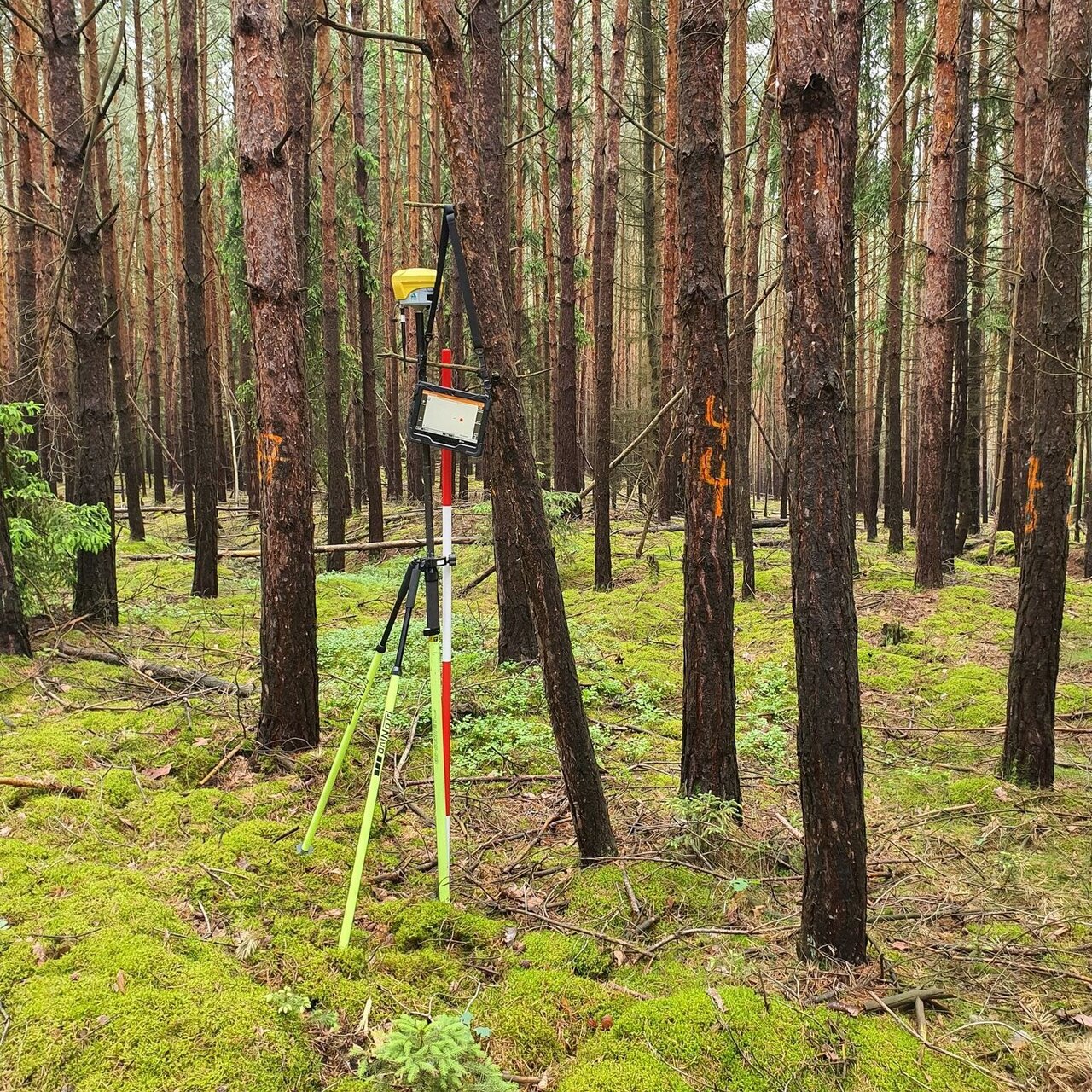
In order to be able to make statements about forest condition using remote sensing (RS), reference data collected on the ground, so-called ground truth data, is required. This project is investigating how the individual tree information from the forest condition survey (WZE) can best be linked with remote sensing data.
Background and Objective
The vitality of around 10,000 trees in Germany is recorded annually as part of the forest condition survey. It forms the basis for deriving long-term time series on forest health and is part of the European ICP Forests monitoring program. As the quality of remote sensing data continues to improve, the demands on the WZE are also increasing. The WZE data is increasingly in demand for calibration and validation purposes (ground truth). Remote sensing, for its part, offers opportunities to record spatial patterns of tree crown defoliation over a wide area. In addition, high-resolution data make it possible to include the forest structure and competition situation of trees as important influencing variables in analyses. The aims of this project are 1) to collect the necessary geo-information to make the WZE usable for precise ground truthing and 2) to explore the potential of integrating remote sensing data to improve the WZE.
Approach
- Data collection: systematic and accurate measurement of the WZE sampling points and tree positions using the RTK-GNSS measurement system and polar method in cooperation with the federal states
- Tree crown delineation from airborne laser scanning data in cooperation with the Digital Twin project of the Federal Agency for Cartography and Geodesy and crown-stem matching with the ground truth data of the WZE
- Pixel-sharp intersection of satellite data using the crown polygons and search for statistical correlations between vegetation indices from FE with vitality parameters of the WZE field survey.
- Investigation of the crown competition situation of survey trees; influence of competition on crown defoliation
- Mechanistic modeling of the relationships between crown volume, leaf area and distribution, crown defoliation, leaf area index (LAI) and RS-based vegetation indices
Thünen-Contact

Involved Thünen-Partners
Duration
4.2023 - 3.2026
More Information
Project status:
ongoing
- 0
Mc Kenna A, Fassnacht FE, Knapp N (2025) Ground-truthing of satellite-based forest condition products using precise tree positions. In: Albrecht S, Sczecina J, Cisewski B, Rzenno L (eds) KIDA-KON : AI for research in food, agriculture and environment ; Conference 17 - 18th September 2025, Johann Heinrich von Thünen Institute, Federal Research Institute for Rural Areas, Forestry and Fisheries, Braunschweig ; Reader. p 30, DOI:10.48480/kida-2025


