Project
GEOS-EUDR: Earth observation for supporting deforestation-free supply chains
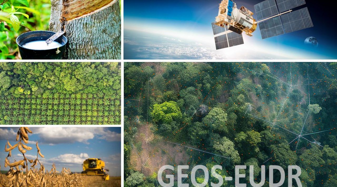
Geospatial remote sensing-based detection of land use change in support of the EU regulation on deforestation-free supply chains
The aim of the research project is to contribute to the improved feasibility of the EUDR in the field of geolocalization and the detection of deforestation and forest degradation using remote sensing and geocomputation
Background and Objective
The GEOS-EUDR project accompanies the implementation of the EU regulation on deforestation-free supply chains (EUDR) from a scientific perspective. The aim of the research project is to contribute to the operational feasibility of the EUDR with a focus on geolocalization and the detection of EUDR-conform deforestation and forest degradation using available remote sensing-based products and geocomputation. It considers the feasibility of an EUDR-compliant implementation along the entire stakeholder chain - from geodata collection by producers (often organized in smallholder structures and farming cooperatives) to the desk-based monitoring by national authorities.
The project improves the data basis and methodology for EUDR-relevant mapping purposes, which can be used by producers (e.g., smallholders and farming cooperatives), enterprises in the EU (referred to as ‘operators’ in the regulation), and national competent authorities (CA).
GEOS-EUDR uses and describes exclusively open-source applications and products (data and software) in order to promote global application and enable subsequent use. All project results, methods and map products are made publicly available (e.g., in online servers such as Google Earth Engine or Thünen Atlas, and repositories such as GitHub). Selected results, methodological innovations and policy recommendations derived from them are disseminated in conferences, peer-review publications and webinars, practical handouts and project briefs, and made available in relevant online forums.
Target Group
Policy, science, stakeholders affected by the EUDR (market participants, control authorities, producers)
Approach
The project is investigating the feasibility of the EUDR using globally and regionally available reference maps (e.g., forest cover, cropping areas) and local reference information in up to three pilot regions of the Global South. Possibilities and limitations to differentiate among relevant land use types (e.g., field crop-dominated cultivation systems, agroforestry, naturally regenerating and planted forest) are assessed for the context of the pilot areas and with regard to EUDR-conform deforestation and forest degradation. A geodatabase and reference maps to differentiate between different EUDR-related commodities (coffee, cacao, soy, rubber, timber, beef, oil palm) are developed based on available information. Desk-based results will be compared with on-site data from producing countries in the Global South in order to assess the accuracy of the available or newly produced map products.
The project cooperates with GIZ projects (INA)in selected regions and relevant production sites. Available local geodata will be used for this purpose. Areas for EUDR-specific agricultural commodities and timber production, and their relevant land use classes will be considered. In addition, GEOS-EUDR is investigating the separability of the land use categories 'other wooded land' and 'other natural ecosystems' at landscape-level in preparation of the upcoming reviews of the regulation.
The project shows possibilities and limitations in differentiating between different EUDR-compliant land use types, and thus provides an important input for policy makers whether to extend the scope of the EUDR to 'other wooded land' and 'other natural ecosystems'. By linking the desk-based remote sensing analyses with short ground truthing campaigns and key informant interviews in selected study regions, the practical implementation of the EUDR will be verified and recommendations can be developed for all stakeholders involved (e.g., producers such as smallholder farmers and farming cooperatives, importing enterprises, national competent authorities).
Our Research Questions
- What EUDR-relevant spatial reference information is generally available at the global level?
- Which regions have the highest spatially-explicit coverage of EUDR-relevant forest reference information and relevant agricultural areas?
- How much do map products differ in the coverage of forest boundaries at landscape level?
Thünen-Contact

Involved Thünen-Partners
Involved external Thünen-Partners
- Deutsche Gesellschaft für Internationale Zusammenarbeit (GIZ) GmbH
(Bonn, Deutschland)
Funding Body
-
Federal Ministry for Economic Cooperation and Development
(national, öffentlich)