![[Translate to English:]](/media/_processed_/6/4/csm_titel_CO2Kampagne8_afeea2273e.png "[Translate to English:]")
![[Translate to English:]](/media/_processed_/4/1/csm_titel_93px_CO2Kampagne8_9b0f3354d4.png "[Translate to English:]")
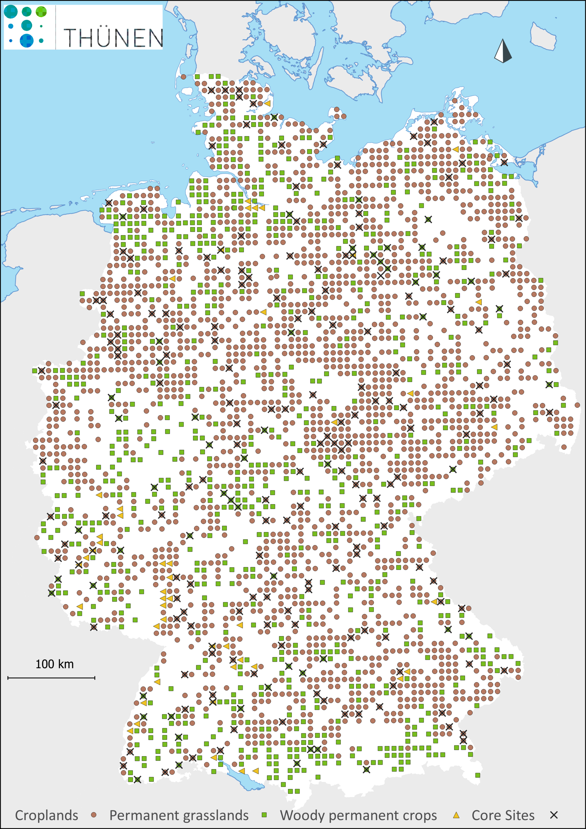
Based on a systematic grid of 8 x 8 km, a total of 3,104 sites on agricultural land are investigated throughout Germany. The sampling points were generated in a randomized procedure. This is based on the distance between the points and the land uses arable land, grassland and special crops from the current Digital Basic-Landscape-Modell (DLM).
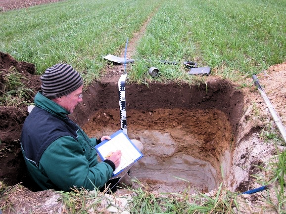
During the initial sampling, standardized soil material was taken on each sampling site. A 100 cm-deep central profile was described and sampled according to soil mapping instructions. Small-scale variability was also recorded within a 10 m radius of the sampling point by pile-driven coring. The exact position of the central profile was determined using differential GPS. In addition, a subsurface marker was buried on the profile wall for retrieval using an active metal detector.
Furthermore, soil samples were also analyzed for nitrogen content, CaCO3, pH, electrical conductivity, bulk density, stone content, and soil texture (grain size distribution)
Soil carbon stocks can be influenced by the history of the land use and management on each site. A questionnaire was therefore used to collect further information on the sampling site and the whole land of the farmer in order to use for scientific evaluation. All data and information are treated strictly confidentially and are only processed anonymously. The contents of the questionnaire were and are exclusively used internally in the context of aggregated, scientific evaluation.
For the second inventory, the following methodological adjustments were made for various reasons:
- The survey of the participating farmers on land management should be done via a digital questionnaire if possible.
- Agriculturally-used organic soils (a total of 147 out of 3,104) will not be re-sampled. Instead, a nationwide Peatland monitoring program for climate protection will be conducted by the Thünen Institute at the same time.
- The sampling depth will be reduced from 100 to 50 cm, because changes below 50 cm depth cannot be detected in an interval of 10 years.
- Static variables such as stone content and soil texture (grain size distribution) are not recorded again, but the effective cation exchange capacity and base saturation are determined, which can be used both as indicators of soil condition and to explain carbon stocks.
- Instead of a large central profile pit and eight percussion core soundings in a 10 m radius, only four small pits are constructed within a 12 x 12 m square around the original sampling point. The square is designed to allow seven additional follow-up inventories theoretically to take undisturbed, and representative samples around the initial profile. The entered and potentially damaged area is significantly reduced in size compared to the initial inventory.
.")