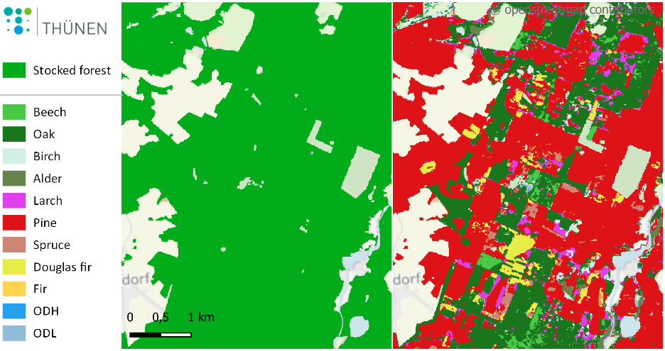
 und zu den dominierenden Baumarten (rechts) mit Übersicht der kartierten Baumartengruppen.")
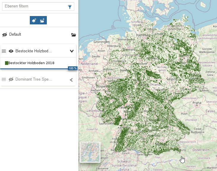
The Thünen Institute now offers interactive forest maps through the Thünen Atlas (atlas.thuenen.de), which provide a nationwide overview of the stocked forest area – i.e. the area on which trees grow – and the dominant tree species. They are not limited to being important sources of information for public authorities, policy, NGOs and associations, but can also be used for further forest and environmental research and education.
The digital maps have a resolution of 10 m x 10 m. The map of dominant tree species is based on data from the Sentinel satellites. These satellites are part of the Copernicus Program form the European Space Agency (ESA) and are used for global environmental monitoring, for example to record changes in land use, to monitor water bodies and coasts, and to collect satellite-based climate data. The nationwide consistent data sample from the 2012 National Forest Inventory (www.bundeswaldinventur.de/) and the 2017 Carbon Inventory were used for tree species classification and for the comprehensive statistical validation of the maps.
Satellite data thus provide valuable complementary information for monitoring current forest state and forest development. However, the level of detail on forest ecosystems required by policymakers and society goes beyond what is observable from the satellite. The main source of information on our forests will therefore continue to be terrestrial inventories such as the National Forest Inventory, the Carbon Inventory and the National Forest Soil Inventory.


