![[Translate to English:]](/media/_processed_/e/3/csm_Demetra2_c8a192c0f8.jpg "[Translate to English:]")
![[Translate to English:]](/media/_processed_/e/2/csm_Demetra1_Panorama_8557ee3b13.jpg "[Translate to English:]")
Landscape Ecology
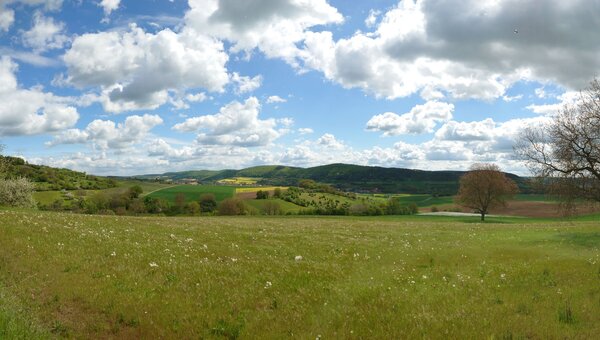
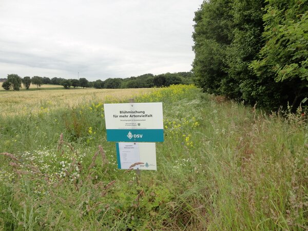
A key landscape ecology question is how much area of semi-natural habitats and agri-environmental measures is necessary and how this should be distributed spatially and temporally in order to achieve specific biodiversity targets in agricultural landscapes. Concrete values for these key parameters of agricultural landscapes and the necessary connectivity and temporal constancy of habitats and measures are hardly known so far. The aim of our research is to identify threshold values (benchmarks) of landscape structure that are sufficient for achieving certain biodiversity targets in order to be able to use agri-environmental funding as efficiently as possible.
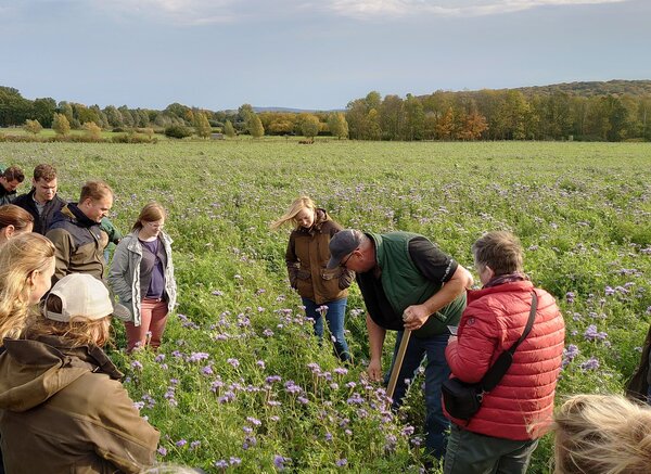
Living Labs (LL) in agroecology act as catalysts for knowledge creation and innovation. They are testing spaces for the practical application of innovative solutions with concrete implementations on the ground. LLs create an efficient network to promote dialogue and a co-learning environment between key actors. The design and development of solutions together with key actors, the evaluation of agricultural practices or the testing of measures and technologies on a landscape scale are at the forefront. Agro-ecological processes can be analysed in a LL at the landscape scale. For this purpose, we are establishing so-called landscape laboratories . The analysis uses transdisciplinary approaches and considers different perspectives from the point of view of farmers and scientists as well as interactions, such as socio-economic relationships or ecological-technological relationships. We use LL in the sense of a research infrastructure to determine the biodiversity impact of agroecological measures at the landscape level, to accelerate the introduction of sustainable agricultural practices and to support future agroecological and agricultural policy initiatives in Germany.
Landscape Lab
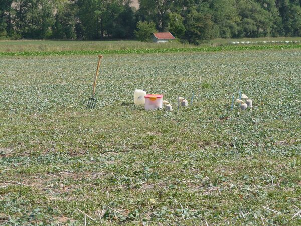
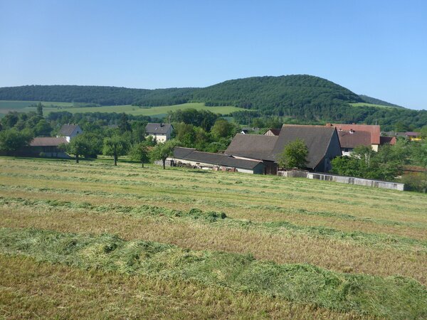
A landscape laboratory is a specially selected section of the landscape in which a goal-oriented (multi-criteria), fundamental and long-term change in agricultural production methods is implemented. Landscape laboratories serve as real laboratories for the investigation of landscape-wide changes in structuring processes. Here, processes or structures are changed at the landscape level, measuring equipment is provided, regular monitoring is carried out and data is collected and made available.
Current topics
Living labs are relatively new approaches in research. So far, the focus of agroecological research has been on individual farmland and field experiments. However, these research approaches can hardly capture complex interactions and quickly reach their limits when it comes to overarching questions. The farm and landscape level, where systemic approaches play a special role, will therefore come more to the fore in our transdisciplinary research.
Living Labs, implemented as landscape laboratories, are for us a promising approach to address problems and challenges of agriculture with the participation of all relevant stakeholders. In Living Labs, scientists and farmers work together with actors from other sectors (GOs, NGOs and other actors from the value chain) in real environments and on real problems. In landscape labs, innovative agroecological methods and measures are developed, implemented and scientifically monitored together with farmers and other stakeholders in co-design processes.
Responsible Scientists: Jens Dauber, Stefan Schrader, Jan Thiele
A landscape laboratory is a specially selected region in which a goal-oriented (multi-criteria), fundamental and long-term change in agricultural production methods is implemented. An alternative production system is established, as uninfluenced as possible by the surrounding cultivation system, which is accompanied and comparatively observed throughout the expected transformation phase(s) by interdisciplinary monitoring and practice-oriented research. In the process, the four sustainability fields of environment/biodiversity, economy, society and politics are mapped equally by data and indicators to enable a comprehensive comparison between status quo and innovation in terms of sustainability. In the Landscape Laboratory, a systems approach is pursued that includes both production and non-production areas.
Our work in landscape laboratories currently focuses on the promotion of insects in the agricultural landscape and the use of ecosystem services (pollination, natural pest control) in cropping systems. In addition, we analyse the structure and functioning of LLs and comparable research infrastructures multi-criterially, using indicator systems, in order to evaluate their effectiveness with regard to an agro-ecological transformation of land management. We also use landscape laboratories to study soil biodiversity and its performance under different forms of land use and different management intensities. For this purpose, landscape sections are set up across Europe as lighthouse sites that serve as observation platforms. The decomposition of organic matter by soil organism communities in landscape laboratories with different cultivation focuses serves us as an indicator for the assessment of nutrient cycle regulation as an essential ecosystem service of the soil biodiversity pool.
How much semi-natural habitat or agri-environmental measures are needed in the agricultural landscape and how should they be spatially distributed to maintain a certain level of biodiversity? We look for critical thresholds and identify target values of landscape structure (benchmarks) for promoting biodiversity in agricultural landscapes.
Responsible scientists: Jan Thiele
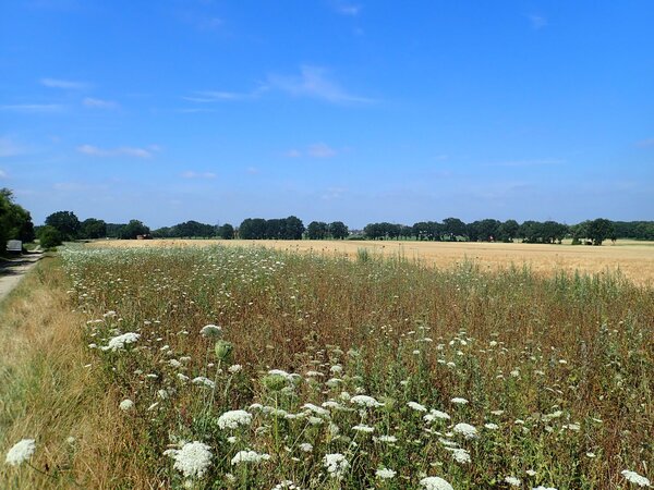
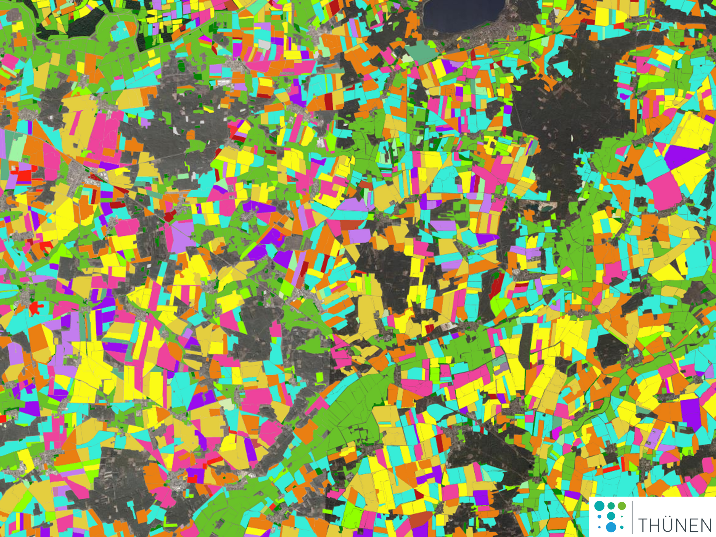
The composition of the landscape from different types of land (landscape composition) and their spatial distribution (landscape structure) affect the biodiversity of many species groups. Since many typical plant and animal species of the cultivated landscape do not find a habitat or sufficient food supply on intensively managed land, semi-natural habitats, such as hay meadows, hedges and field copses, and agri-environmental measures (e.g. flower strips) play an important role in maintaining biodiversity. In general, the species richness of the agricultural landscape depends strongly on the area of semi-natural habitats. If the proportion of habitats in the landscape is low, functional connectivity, i.e. the possibility of recolonisation and re-colonisation of areas, plays an important role in the long-term survival of species.
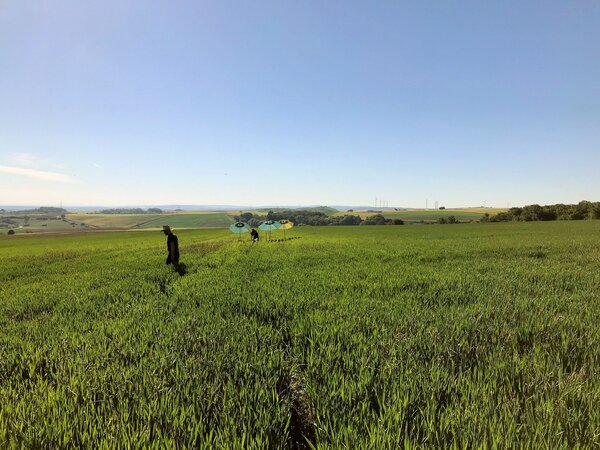
Our research aims to quantify the effects of landscape composition and structure on the species richness and abundance of different groups of organisms (insects, plants). The basis of our models is the analysis of landscape condition and change by calculating measures of landscape properties (landscape dimensions) in Geographic Information Systems (GIS). Through statistical modelling, we quantify the relationships between species richness and abundance of organisms and key landscape measures based on empirical field research. Furthermore, we apply simulation models of populations of selected species representing different functional species groups (e.g. pollinators, beneficial insects) to virtual landscapes in which landscape properties are deliberately varied. In this way, we investigate gradients in the quantity, distribution and temporal constancy of habitats and food resources to identify thresholds of landscape endowment.
The type and intensity of land use determine the limits of ecological resilience of crop systems. Soil organism communities with their functions and their performance potential have a large share in the resilience of useful ecosystems. We investigate soil biodiversity and its ecosystem services of different land use systems under consideration of different management intensities.
Responsible scientists: Stefan Schrader
Soil biodiversity plays a central role in multiple ecosystem functions and ecosystem services. However, the precise contribution of soil organisms alone and in interaction in regulating multiple ecosystem functions and services in different biogeographical regions and land uses is largely unknown. In an experimental approach, we aim to identify general ecological patterns in the distribution, abundance, diversity, interactions and functioning of soil organisms in the provision of multiple ecosystem functions and services, and to support their conservation and consideration through action. For this purpose, we are investigating different land use types and different intensity levels at the landscape scale (here: Agriculture, forestry, urban, post-mining, (semi-)natural). Lighthouse sites will be set up as observation platforms for this purpose. The focus is on gaining new insights into soil ecosystem functions and services in relation to soil organisms, and on developing new indicators, tools and incentives to identify and monitor key organisms that contribute to ecosystem services in European land uses.
The different management and cultivation systems in the agricultural landscape control the activity and performance of soil organism communities. Quantifying the biodegradation of organic matter in landscape sections with different cropping systems serves us as an indicator for the soil ecological assessment of these agricultural landscapes.
Responsible scientists: Stefan Schrader
Biodegradation of organic matter releases nutrients in the soil for plant growth. The communities of soil organisms thereby control nutrient cycling as an essential ecosystem service that is essential for ecosystems to function. In agroecosystems, it is mainly crop residues and dead roots that are decomposed. Soil animal communities perform several functions in this process: (i) They break down organic residues, creating larger surfaces that are conducive to microbial decomposition. (ii) They eat organic matter and transform it in the digestion process into qualitatively modified excreta products that are further processed by other soil organisms. (iii) They graze microbial growth (bacteria, archaea, fungi, algae, protists), thereby stimulating microbial compensation growth and ultimately acting as catalysts of increased microbial activity. For the assessment of natural processes in agroecosystems, a crucial question is which degradation performance soil animal communities provide depending on different crops.
So far, we conducted comparative decomposition experiments with earthworms on the decomposition of litter of the annual crop maize and the perennial crop of volunteer silphia. The decomposition rates were higher for the litter of the volunteer silphia. We obtained a comparable result in a field trial with both crops using litter bags for soil microarthropod communities. We also investigated the importance of a mixed crop for the decomposition performance of soil animals. Here, a higher decomposition rate of litter by soil microarthropod communities was found with mixed culture of maize and sainfoin compared to the single crops. In the next step, we will investigate the degradation behaviour of soil organism communities using the TeaBag approach on the landscape scale in so-called Living Labs, which are formed by practical farms. Based on a spatial grid, the TeaBag index to be calculated will serve to assess the decomposition of organic matter among the crops of the respective landscape section.
Insects provide important ecosystem services in agricultural landscapes, such as pollination of crops and control of pests by beneficial insects. Due to the decline in insect species richness and biomass, these ecosystem services are limited. We are investigating how pollinator and beneficial insect species in agricultural landscapes and the ecosystem services they provide can be promoted in a targeted and efficient manner.
Responsible scientists: Jens Dauber, Jan Thiele
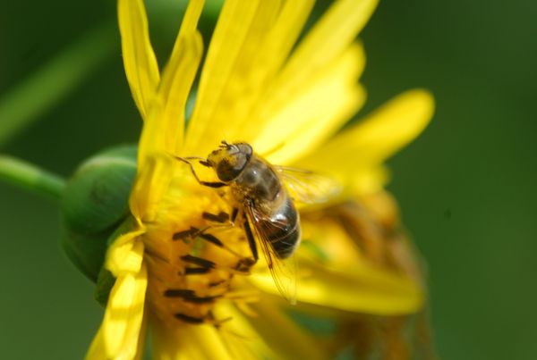
We develop simulation models of selected pollinator and beneficial insect species in order to predict their population development as a function of landscape features and structure. To do this, we use agent-based models that map insect behaviour, e.g. foraging and reproduction, and interactions with land management (e.g. ploughing, pesticide use, mowing) as well as vegetation phenology and food resources over the course of the year. The simulations run in virtual landscape sections of several square kilometres, so that interactions with the spatial and temporal distribution of resources and stressors can be represented and analysed at the landscape level. We use the models to determine the minimum requirements of agricultural landscapes for the conservation of pollinators and beneficial insects and to investigate how populations respond to changes in land use and agri-environmental measures. In this way, the effect of changes in agricultural policy or future scenarios of agricultural landscape development on ecosystem services and insect biodiversity can be determined in advance.
Habitat connectivity in the landscape can be crucial for the regional survival of species, especially if the habitat share is low and the mobility or dispersal capacity of the species is low. We investigate which arthropod and plant species depend on habitat connectivity and which land use or ecosystem types inhibit or promote their dispersal.
Responsible scientists: Jan Thiele
The movement or dispersal of animal and plant species is promoted or inhibited to different degrees by the various landscape components (e.g. fields, forests, hedges, etc.). The effect of landscape components depends strongly on the characteristics of the species, especially habitat requirements and movement/ dispersal capacity. While, for example, hedgerows and hedgerows can be dispersal corridors for species that occur mainly in grassland or in woodland, they may be barriers for species in fields. So far, however, knowledge about the effect of landscape features on the dispersal of small animals (arthropods) and plants is very limited. We investigate 1) the resistance of different landscape components to the dispersal of arthropods and plants, and 2) whether and to what extent their dispersal depends on the composition and structure of the landscape. For the studies, we divide arthropods and plants into ecological groups based on habitat preference and dispersal ability.
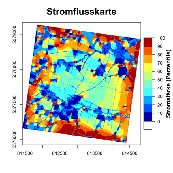
We use the concept of landscape resistance for our investigations, where resistance can be seen as the inverse of connectivity. The calculation of landscape resistance is based on landscape grids in which different local resistances are assigned to different land cover types (resistance grids). The total resistance between two points on the resistance grid can then be calculated based on circuit theory according to Ohm's law.
In the first step, we determine the local resistances of different land cover types for different ecological species groups by an optimisation algorithm (R package resistanceGA), using data on arthropod and plant communities from field studies as optimisation criteria. In a second step, we model the effect of landscape resistance on species communities with statistical models to estimate the importance of landscape connectivity for each species group.
The aim of this research topic is to determine for as many arthropod and plant species of agricultural landscapes as possible whether connectivity (or landscape resistance) is important for them and which landscape components can promote dispersal or represent barriers.
Farm size is crucial for environmental, economic, and human wellbeing, but obtaining accurate farm size data is challenging and costly. Small farms are often considered more socially and en-vironmentally sustainable, but data on farm size is prone to bias. Field size data, used as a proxy for farm size, shows promise in overcoming these limitations through remote sensing techniques, but there is a lack of empirical knowledge on the farm-field size relationship for larger areas. Understanding the impact of farm and field size on food security and sustainable agriculture remains a challenge, including identifying determinants of farm/field size patterns, assessing management practices along size gradients, and quantifying environmental and so-cio-economic impacts.
Responsible scientists: Jens Dauber, Christian Levers
Farm size is linked to environmental, economic, and human wellbeing and knowledge about farm size distributions can foster the development of actions to address food security and agricultural sustainability. Small farms are assumed to be more socially and environmentally sustainable than large farms, have a lower impact on natural ecosystems, have a higher level of resilience and adaptive capacity, and allow maintaining intergenerational economic welfare and biodiversity. Yet, farm size data are costly to collect and prone to bias, hampering the availability of consistent data sets covering large areas. Field size data as a proxy for farm size is promising to overcome this limitation, as it facilitates the understanding of field-level farm management and can be mapped more reliably over larger areas via remote sensing techniques. However, empirical knowledge about the farm-field size relationship for larger spatial extents is largely unclear. Furthermore, understanding the role of farm and field size for achieving food security and sustainable agriculture targets remains a challenge. This ranges from identifying the leading determinants of farm/field size patterns, over assessing the intensity with which farms and fields are managed along size gradients (e.g., fertiliser input, machinery used, crops cycles), to quantifying environmental and socio-economic impacts of in response to farms and field size.
In this research topic, we address the following overarching research question:
- What is the empirical relationship between farm and field size in Germany’s agricultural landscapes, and what leading spatial determinants explain their patterns?
- What is the relationship between agricultural farm/field size and land-use intensity in Germany?
- What are the environmental and socio-economic impacts of related to the size of agricultural farms and fields in Germany?
Land-use models are key tools to address sustainability challenges related to land-based produc-tion systems as they allow understanding and estimating impacts of different management deci-sions on the environment, economy, and society. They also help identifying the most sustainable and effective solutions to balance competing demands for land use, such as food production and conservation. Such knowledge is critical to support informed decision-making by policymakers, land managers, and communities to achieve long-term sustainability goals.
Responsible scientists: Christian Levers, Jan Thiele
Germany is characterised by a complex land system that needs to satisfy multiple competing demands, including from agriculture, forestry, urbanisation, and conservation. Especially the highly intensified agricultural and forestry systems occupy large parts of the country and are key drivers of environmental degradation and biodiversity loss over the past decades. As a result, Germany’s land system is required to undergo a transformation to meet the sustainability targets set by national and international agreements and regulations. Yet, the impacts of required changes in land management on societies and the environmental are unclear. Land-use models can help to address this knowledge gap by providing a comprehensive and integrated framework to simulate and evaluate the impacts of different land use scenarios. By integrating data on land-use patterns, Nature’s Contribution to People, climate change impacts, and socio-economic factors, land use models can help identify solutions that enable balancing the competing demands for land use. Results can directly feed into evidence-based decision-making by providing policymakers, land managers, and communities with an option space of the potential outcomes of different land use decisions. This can help avoid unintended consequences and support the development of long-term sustainability strategies that are socially, economically, and environmentally sound.
In this research topic, we address the following overarching research questions:
- What are the trade-offs between local, regional, national and EU-wide policies and objectives for the German soil system, especially for biodiversity patterns and trends?
- Where are the hotspots for conflicting goals between the different sectors, e.g. agriculture, forestry and nature conservation, and what are their spatio-temporal dynamics?
- What is the potential for transferring local and regional measures to achieve biodiversity targets to the national level based on land use simulations?
- How can land use simulations be used to test policies and interventions to support scientific policy advice?
Grassland shapes the cultural landscape in the north-west German coastal region and in many low mountain ranges and is important for maintaining the species richness of these landscapes. Grassland also provides a wide range of services for people.
Responsible scientists: Jens Dauber, Sebastian Klimek, Jan Thiele
These so-called ecosystem services range from the provision of native fodder for animal husbandry to contributions to species, water and climate protection to leisure and recreational benefits for society. However, structural change in agriculture is progressing. In particular, species-rich grassland areas in low mountain regions are threatened not only by an intensification of grassland management but also by an increasing reduction in livestock and the associated abandonment of use and scrub encroachment. In the lowlands, ecosystem services are acutely threatened by climate change.
We are particularly concerned with the following research questions in grassland:
- What do site-adapted management concepts that correspond to the plant population and the farm structure look like - especially for low mountain grassland?
- How can agri-environmental measures be further developed to specifically conserve and promote species-rich grasslands?
- What are the impacts of climate change on grassland biodiversity, especially with regard to flora and vegetation?
- What influence do changes in land use and adapted water management have on grassland vegetation?


