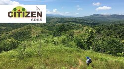
CITIZEN-SDSS
The remaining Philippine forests are threatened by deforestation, forest degradation and climate change. They are also important for the wellbeing of the local population as well as being a global biodiversity hotspot.
This project aims to foster nature-based solutions by including local stakeholder aspirations into land use planning and combining it with a spatial decision support system which shall allow for more sustainable forest management.
More
Copernicus lights green
Land consumption and intensification of use exert high pressure on grassland areas. Recording and assessing the condition and distribution of protected grassland and grassland worthy of protection requires a great deal of effort. In the future, satellite data should support official monitoring with area-wide services.
More
Copernicus Netzwerkbüro Wald
As an interface between remote sensing experts and forest stakeholders, forest owners, forest authorities and enterprises, research institutions and companies, the Copernicus Network Office Forest supports, advises and networks all stakeholders who use or would like to use remote sensing data and services.
More
Earth observation and artificial intelligence for monitoring of organic farming
By 2030, the share of organic farming in Germany aims to be expanded to 30% of agricultural land. Satellite data can help to show cultivated areas and differences in management practices between organic and conventional farming.
More
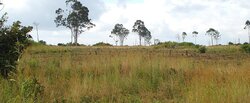
Forest Restoration
Restoring forest lands at the landscape level contributes to Sustainable Development Goals (SDGs) e.g. hunger, poverty, well-being and life on land especially in poor communities of sub-Saharan Africa.
More
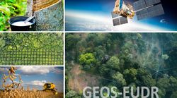
GEOS-EUDR
The aim of the research project is to contribute to the improved feasibility of the EUDR in the field of geolocalization and the detection of deforestation and forest degradation using remote sensing and geocomputation.
More
Monitoring biological diversity in agricultural landscapes with remote sensing
A long-term monitoring of biological diversity at national level requires a representative data basis about the state and development of agricultural landscape. To achieve this, the project MonViFE develops spatially explicit indicators of landscape structure and land-use intensity.
More
Monitoring of climate-impacting measures in crop and grassland management with satellite data
With 66.4 million tons of CO2 equivalents, agriculture was responsible for 9 % of greenhouse gas emissions in Germany in 2020. Adaptations in farm management can reduce these emissions. Area-wide data on such adaptation measures will be derived from high-resolution satellite data.
More
National Scale Tree Species Mapping for Germany
The project aims at generating wall-to-wall tree species distribution maps for the area of Germany by using National Forest Inventory data within remote sensing analysis.
More
Remote sensing for improved climate reporting (KlimaFern)
Land use and agricultural measures are essential domains for achieving climate protection targets. Satellite data will be used to monitor agricultural land use over a wide area and to improve the data basis for reporting.
More
Automatic determination of grassland use intensities by means of satellite image time series
Nationwide information on grassland use intensity is still unknown in Germany. Remote sensing data can help to close this knowledge gap in the future.
More
Development of an automated support system to monitor agricultural funding and compensation sites (timeStamp)
Site-related measures in the agricultural funding and the intervention scheme are currently checked with time - and cost-intensive on spot checks. A Web application, based on remote sensing data, should change that.
More
Ecological and Socioeconomic Functions of Tropical Lowland Rainforest Transformation Systems
The transformation of tropical rainforest to rubber and oil palm plantations has extensive impact on nature and living conditions. Remote sensing helps us to understand the spatial-temporal patterns and drivers of those processes.
More
I spy with my little eye: automated detection of agricultural parcels and crops using satellite images
German-wide and plot-specific land use data is so far not public available. This can change due to the new data from satellite imagery from the Copernicus program (Sentinel), which is free and taken at a high frequency.
More
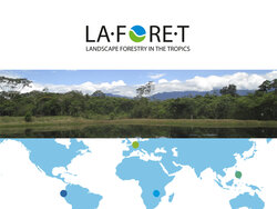
Landscape Forestry in the Tropics
LaForeT schätzt den Einfluss monetärer Anreizsysteme und von Governance-Instrumenten auf räumliche und zeitliche Muster der Landnutzung sowie die Auswirkungen auf Waldbedeckung, Kohlenstoffspeicherung, Parameter der Baumarten-Diversität sowie die Existenzgrundlagen der lokalen Bevölkerung ab.
More
Monitoring groundwater levels in peatlands with radar data
Greenhouse gas emissions from organic soils are strongly influenced by the groundwater level. Deriving groundwater levels from remote sensing data could strongly improve the spatial and temporal resolution of greenhouse gas emission estimates.
More
National Scale Tree Species Mapping for Germany
The project aims at generating wall-to-wall tree species distribution maps for the area of Germany by using National Forest Inventory data within remote sensing analysis.
More
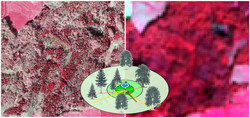
Remote sensing based National Forest Damage Monitoring System
Drought, storms, forest fires and insect pests have caused increasing damage to forests in Germany in recent years. For crisis management, reliable information on the extent, distribution and development of damage is required.
More
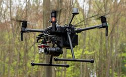
UAVs Forest Monitoring
Study on the use of UAVs in forest monitoring
More


 of an agricultural region in Brandenburg in false color representation. The plot shows radar-based (blue) and optical (green; Sentinel-2) indices for a meadow with two cuts.")


)")