

Project
EOekoLand - Earth observation and artificial intelligence for monitoring of organic farming
Earth observation and artificial intelligence for monitoring of organic farming
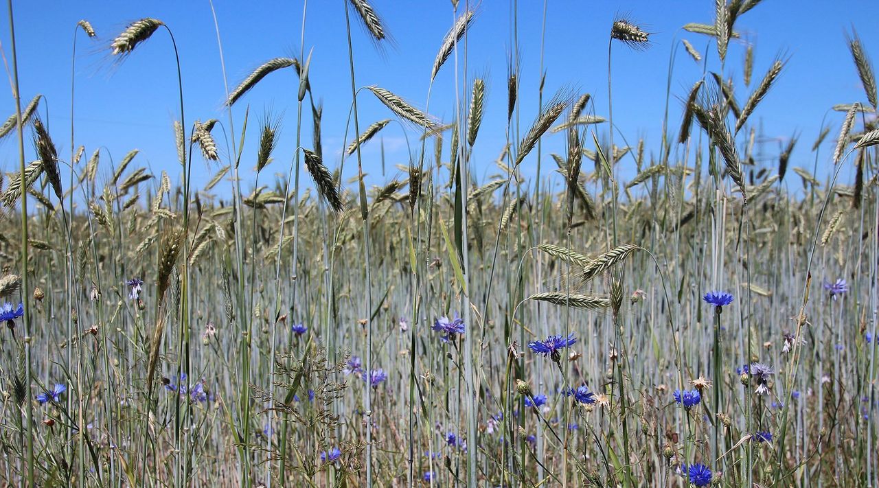
By 2030, the share of organic farming in Germany aims to be expanded to 30% of agricultural land. Satellite data can help to show cultivated areas and differences in management practices between organic and conventional farming.
Background and Objective
The expansion of organic farming and the digitalization of agriculture are effective means of achieving sustainable agriculture. At the same time, in view of the current global political situation, food security in the world and Europe is of growing importance. Therefore, food sovereignty, food security and ecologization must be achieved in equal measure.
The availability of digital data on land use in organically managed farms compared to conventional farms is an important prerequisite for the evaluation of policy measures and the assessment of target achievement in the expansion of organic agriculture. Satellite data, together with other spatial data on environment and climate, provide the basis for nationwide mapping of agricultural land use. However, the detection of differences between organic and conventional land use is limited on the basis of the data available to date and conventional methods of image evaluation. Artificial intelligence (AI) methods and high-resolution satellite data can help to better identify spatial and temporal patterns of land use and differences between organic and conventional farming in the complex and diverse data.
Overall (general) objective:
Develop an area-wide data basis for evaluating the scope, measures, and effects of expansion of organic agriculture in Germany using Copernicus and additional satellite data and artificial intelligence (AI) methods.
Approach
Within the scope of the overall objective, a technical and methodological concept is to be developed and implemented on a test basis in selected regions of Germany.
The scientific-technical (operational) objectives to achieve the general objective include:
- Establishment of a (reference) database on land use and productivity in organic farming and in comparison to conventional farming.
- Visualization of area-wide cultivation patterns in the agricultural landscape with reference to organic farming.
- Develop and test technologically innovative solutions based on satellite remote sensing and AI that reveal the scale, productivity (intensity of use) and impact of organic agriculture.
- Evaluation of the potential of (commercial) high resolution satellite data and their added value compared to (free) Copernicus satellite data for monitoring in organic agriculture.
- Description of (natural and environmental) factors that favor or hinder a transformation from conventional to organic farming.
Data and Methods
The data of the Sentinel satellites of the European earth observation program Copernicus (Sentinel-1 / -2) with their high spatial and temporal resolution form the data basis for this project. In addition, high-resolution satellite data from the Co. Planet Labs are available for the project. The high repetition rate of the individual Sentinel satellites and their fusion with the Planet data to form a dense time series enable the area-wide observation of the agricultural landscape at intervals of a few days. Temporal and spatial patterns in the agricultural landscape related to organic farming (e.g. crop rotations, crop diversity, phenology) are analyzed using machine learning methods.
Our Research Questions
In the context of the objectives, the following questions are posed for the project:
- How have the cultivation structures in the agricultural landscape already changed in recent years and what part has the expansion of organic farming played in this?
- How do cultivation areas/structures and productivity differ between conventional and organic cultivation (and within organic cultivation)?
With regard to the use of remote sensing data, this raises the following questions:
- Can the patterns and trends of land use and the differences between organic and conventional farming be captured with satellite remote sensing data and methods?
- Can the integration of high-resolution satellite data with Copernicus data (Sentinel-1/-2) and services generate additional value?
- What potential does the use and further development of artificial intelligence methods offer with regard to the spatial and temporal transferability of methods and models?
Thünen-Contact
Involved Thünen-Partners
Involved external Thünen-Partners
- Technische Universität Berlin
(Berlin, Deutschland) - Forschungsinstitut für biologischen Landbau Projekte GmbH (FiBL)
(Frankfurt, Deutschland)
Funding Body
-
German Aerospace Center (DLR)
(national, öffentlich)
Duration
8.2022 - 1.2025
More Information
Project funding number: 50RP2230A
Project status:
ongoing