Project
Development and validation of the modelling of storm damage in forests
Monitoring and forecasting possibilities of storm damage in forests
Extreme weather events have become more frequent in recent years. A study by the German Insurance Association (GDV) and the Potsdam Institute for Climate Impact Research (PIK) estimates a 50 percent increase in general storm damage by the year 2100 (Donet et al 2011). Throughout Germany, the winter storm "Friederike" alone caused 17 million Fm of storm damaged timber in 2018 (Forstpraxis, 2018). This means that approx. 30% of the total felling was unplanned, instead of through targeted sustainable use. Even after storm Xavier in autumn 2017, the estimates of the Brandenburg Forest Administration amounted to about 1 million Fm of additional timber to be cleared, which means about 1.5 to 2 million individual trees thrown in Brandenburg (MLUL, 2017).
Background and Objective
Damage caused by windthrow or log breakage has far-reaching economic, ecological and social consequences. Besides the direct damage (primary damage) to the stand caused by storms (windthrow and wind breakage), consequential damage (secondary damage) is mostly caused by subsequent calamities such as bark beetles or other factors such as fire, sun, snow/ice or additional wind damage. Losses (tertiary damage) also occur due to loss of production caused by shortened rotation periods and other long-term restrictions in forest use (Gardiner et. al 2014). In addition, there are higher costs for the much more difficult processing and increased costs of recovery. In addition to the reduced revenue due to the storminduced quality losses, the sales prices for storm damaged timber usually fall sharply again, since the markets are oversaturated by the usually massive volume of storm damaged timber.
Crisis management after storm calamities poses great challenges for forest owners. This is because there is a lack of instruments for minimising the risk in the forest in the event of a storm.
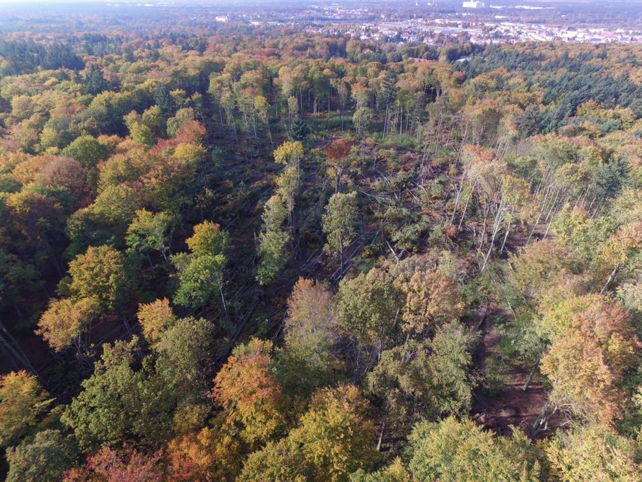
Photographs taken from the forest stand do not show the extent of the damage sufficiently. Pictures from UAVs allow a better overview and a first assessment of the damage area, the direction of throwing or the lying direction of the individual trees. These images are invaluable, especially for the creation of skid trails.
Approach
The planned project therefore aims to develop methods and models to quickly identify and map acute and potential storm casts in the terrain in order to avoid subsequent calamities as far as possible. This can help foresters to detect storm areas even in remote areas, including the rapid detection of infrastructure damage and the targeted prioritisation of upcoming work. Furthermore, the fast and exact determination of the location of the storm area and the better planning possibilities can optimize the felling of transport routes and thus less timber can be felled additionally. In addition, the quick removal of timber helps to minimize calamities caused by bark beetles, for example, and thus to protect the remaining stock.
Thünen-Contact

Involved Thünen-Partners
Involved external Thünen-Partners
-
Hochschule für nachhaltige Entwicklung Eberswalde (HNEE)
(Eberswalde, Deutschland)
Funding Body
-
Fachagentur Nachwachsende Rohstoffe e.V. (FNR)
(national, öffentlich)
Duration
7.2020 - 12.2023
More Information
Project funding number: 2220NR024B
Funding program: FNR
Project status:
finished
Publications
- 0
Grottian L, Stadelmann C, Krüger I, Natkhin M (2022) Storm damage in forests: Insights into Level II data. Eberswalde: Thünen Institute of Forest Ecosystems, 2 p, Project Brief Thünen Inst 2022/26a, DOI:10.3220/PB1662532532000
- 1
Grottian L, Stadelmann C, Krüger I, Natkhin M (2022) Sturmschäden im Forst: Einblicke in die Level-II-Daten. Eberswalde: Thünen-Institut für Waldökosysteme, 2 p, Project Brief Thünen Inst 2022/26, DOI:10.3220/PB1658386102000
- 2
Albert N, Reder S, Stadelmann C, Grottian L, Schmidt J, Hauck J, Natkhin M, Mund J-P (2021) Digitales Krisen- und Risikomanagement vor und nach Sturmschadensereignissen - Eine Umfrage unter Forstakteueren. In: FowiTa : Forstwissenschaftliche Tagung - Wald: Wie weiter? ; Book of abstracts, 13. bis 15. September 2021. p 158
- 3
Grottian L, Stadelmann C, Natkhin M (2021) Vulnerabilität von Forstbeständen für Sturmschäden - Modellierung und Risikominimierung am Beispiel einer forstökologischen Versuchsfläche. In: FowiTa : Forstwissenschaftliche Tagung - Wald: Wie weiter? ; Book of abstracts, 13. bis 15. September 2021. p 314
- 4
Stadelmann C, Grottian L, Natkhin M, Albert N, Reder S, Hauck J, Schmidt J, Mund J-P (2021) WINMOL - Erfassung und Vorhersagemöglichkeiten von Sturmschäden im Forst. In: FowiTa : Forstwissenschaftliche Tagung - Wald: Wie weiter? ; Book of abstracts, 13. bis 15. September 2021. p 319