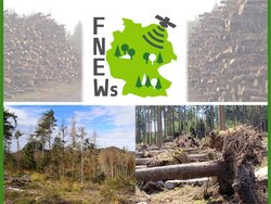
ThEO

Forest structure and dynamics

Katja Oehmichen


WF Institute of Forestry
WO Institute of Forest Ecosystems

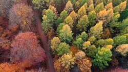
In order to record and monitor the forest in its structure and dynamic development, the Thünen Institute tests and analyses various cross-scale remote sensing data and new remote sensing technologies.

The remote sensing experts at the Thünen Institute are investigating possible applications of remote sensing products in various research projects in order to better answer current questions about the forest. The investigation levels range from small areas of intensive forest monitoring to larger investigation areas to the forest area of the whole of Germany. Forestry as well as ecological parameters are surveyed. With the help of remote sensing, the following goals are to be achieved:

  • Establishment of a nationwide recording system for forest damage
  • Nationwide mapping of tree species in Germany
  • Integration of remote sensing data into the evaluation of the terrestrial federal forest inventory for improved estimation of forest parameters (wood supply, biomass, stand height)
  • Vitality and forest damage analysis
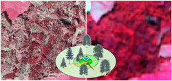
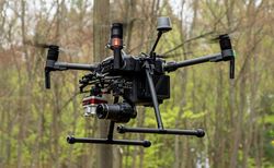
  • Study on possible applications of drones in forest environmental monitoring

Our research questions

  • In what state of vitality are our forests? Which forests are damaged? How large are the damaged areas?
  • How are the tree species distributed across Germany?
  • Which wood stocks and biomass can be found in certain regions?
  • What can artificial intelligence be used for in remote forest sensing?

Projects

First 2.0 (Kopie 1)

Product development for continuous, cross-scale product Vitality and forest damage analysis by means of multisensory Remote sensing data and artificial intelligence

More
First 2.0 (Kopie 1)

Remote sensing based National Forest Damage Monitoring System

Drought, storms, forest fires and insect pests have caused increasing damage to forests in Germany in recent years. For crisis management, reliable information on the extent, distribution and development of damage is required.

More
Remote sensing based National Forest Damage Monitoring System

National Scale Tree Species Mapping for Germany

The project aims at generating wall-to-wall tree species distribution maps for the area of Germany by using National Forest Inventory data within remote sensing analysis.

More
National Scale Tree Species Mapping for Germany

National Scale Tree Species Mapping for Germany

The project aims at generating wall-to-wall tree species distribution maps for the area of Germany by using National Forest Inventory data within remote sensing analysis.

More
National Scale Tree Species Mapping for Germany

UAVs Forest Monitoring

Study on the use of UAVs in forest monitoring

More
UAVs Forest Monitoring

Copernicus Netzwerkbüro Wald

As an interface between remote sensing experts and forest stakeholders, forest owners, forest authorities and enterprises, research institutions and companies, the Copernicus Network Office Forest supports, advises and networks all stakeholders who use or would like to use remote sensing data and services.

More
Copernicus Netzwerkbüro Wald

Cross-section group

Remote sensing

Satellites, planes, drones - What is the potential of remote sensing technologies for observation and measurement in forests? What data can be collected, examined and analysed? Experts from our institute share their knowledge and develop ideas and concepts on remote sensing in the forest.

More
Remote sensing

Scroll to top